Black History Month: Pioneering African-American Civil Engineers

Black History Month is a time to reflect on the contributions and achievements of African-American individuals throughout history. It is a month dedicated to celebrating the rich heritage and accomplishments of African-American people in various fields. One such field that has seen remarkable contributions from African-American individuals is civil engineering. African-American civil engineers have played a pivotal role in shaping history and have paved the way for future generations in this field. Their significance lies not only in their technical expertise and innovative ideas, but also in the barriers they have broken and the opportunities they have created. By overcoming adversity and discrimination, these pioneering figures have not only made significant contributions to the field of civil engineering but have also left a lasting impact on society as a whole. Their achievements serve as a reminder of the importance of diversity and inclusion in the engineering profession. Through their hard work, determination, and unwavering commitment to excellence, African-American civil engineers have not only shaped history but have also inspired countless individuals to pursue careers in engineering. As we celebrate Black History Month, it is essential to recognize and honor the contributions of these trailblazers who have paved the way for a more inclusive and diverse future in civil engineering.

Exploring the contributions of notable African-American civil engineers who paved the way for future generations, we uncover a rich history of individuals who overcame adversity and made significant advancements in the field. One such pioneering figure is Benjamin Banneker, who, in the late 18th century, designed and constructed a series of irrigation canals for the family farm that greatly improved agricultural productivity in Maryland. Banneker's meticulous attention to detail and innovative engineering techniques set a high standard for future African-American civil engineers. Another trailblazer in the field is Howard P. Grant, a prominent civil engineer who graduated from the University of California, Berkeley, in 1948, making him the first African-American to graduate from the Berkeley College of Engineering. That same year, Grant also became the first known black member of the American Society of Civil Engineers. Additionally, we cannot overlook the contributions of George Biddle Kelley, who graduated from Cornell University's College of Civil Engineering in 1908. He went on to become the first African-American engineer registered in the state of New York. He was hired by the New York Engineering Department, where he worked on the Barge Canal, a collection of state waterways, during the 1920s.

These pioneering figures in civil engineering not only made significant contributions to the field but also paved the way for future generations. Their determination, expertise, and unwavering commitment to excellence have left an indelible mark on the profession. As we celebrate Black History Month, it is crucial to recognize and honor the invaluable contributions of these trailblazers and their lasting impact on civil engineering.


 

What is the Role of GIS in Civil Engineering?

Did you know that the geographic information system (GIS) started as a concept in the 1960s?

GIS may have begun as a concept, but thanks to its incredible scientific development, it has evolved into a modern invention. A GIS is a computer program with multiple pieces of software that collect, stores, verify, and present information about locations on the exterior of the Earth. This multi-purpose tool can gather a lot of material data as well as dated information about an area and visualize it to later be used to successfully complete civil engineering projects. This tool gives engineers the advantage of collecting and analyzing geographic data that can later be presented as 3D models. Another advantage of GIS is the ability to identify possible obstacles and opportunities between various sites. What sets GIS apart from any other computer program is its ability to link spatial data with geographic data concerning any element on the map.

GIS tools and software play an extremely important role in civil engineering, especially when considering geographical projects. The most used GIS tools and software in civil engineering consist of AutoCAD Map 3D, which has all of the common CAD capabilities that are available; ArcGIS, which offers a geo-based analytical feature for data; and Blue Marble Geographic, which provides an extensive variety of layout options for data to be imported and exported. Because of its creative solutions, GIS software is being used in the civil engineering industry at a rate that is growing quickly. With the constant changes in our infrastructure generated by the environmental crisis and economic and social factors, GIS enables engineers to identify the best areas for potential future expansion.

Given the variety of tools and software that GIS provides to help engineers effectively and successfully manage any project, it is safe to predict that GIS will continue to play a big part in the civil engineering industry.


What Is Total Station Used For?

Total Station technology was first introduced in the 1900s; however, the first official Total Station tool was created in 1968 by a German company called Carl Zeiss Inc., and during that time, Zeiss called this tool the “electronic tacheometer.” It wasn't until Hewlett-Packard launched a tool that provided similar results, but with the name "Total Station," over thirty years after the electronic tacheometer was created that it adopted its current name.

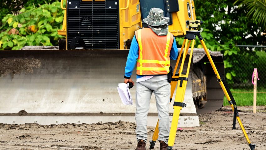
Total Station is an electronic distance measuring device (EDM) that is utilized by land surveyors and civil engineers while performing site surveys and construction work. The Total Station combines the ability to measure vertical and horizontal angles with electronic distances by combining a telescope, computer, and reflector. Total stations are tools that can be placed on the ground and use various sensors to calculate kilometers, angles, sectors, and altitudes, and find items. This is a great tool to use when needing to get the most accurate measurements on a project. After all the data is collected, it can be imported onto computers or laptops for the additional information to be processed.

Total Station has advantages and disadvantages, just like any other tool. The Total Station's measurement accuracy is an advantage, but the cost of the tool increases with increasing measurement accuracy in addition to its features, which can be a disadvantage for many companies. Therefore, buying a Total Station requires a significant investment of funds, so it is important to evaluate which model is best for the kind of work that your company does. Prism total stations, robotic total stations, autolock total stations, and total mechanical stationary are some of the different types of Total Stations. Furthermore, if funds are an issue, there are other tools that can offer an excellent alternative at a small fraction of the cost for projects that do not require precise measurement.


Infrastructure Week, Day 3: Transit

Public transit is a staple of our nation that continues to grow yearly, although remains neglected and radically underfunded.

American transit systems carry billions of people a year via trains, commuter buses, ridesharing services, and more. These systems mainly provide transportation in urban areas but are vital in many rural areas across the county.

In the past few years, we’ve seen major train derailments, non-passengers killed in transit-related accidents, and damaged infrastructure as a result of natural disaster. The resilience of outdated, unreliable infrastructure is tested day by day.

For full functionality of national transit systems, we need not only transit vehicles, but sufficient infrastructure like traffic signals, train tracks, and roadways to successfully carry and guide these vehicles. However, with lack of funding, years of deferred maintenance, and aging infrastructure, our public transit systems continue to suffer.

At KC Engineering and Land Surveying, P.C. (KC), our civil engineering services include roadway and highway design, traffic engineering, lighting design, and other services to maintain and improve transit operations.

With projects like Gowanus Expressway Intelligent Transportation System (ITS) and Emergency Repairs, Greenkill Avenue Bridge Replacement, and Route 9D Pedestrian Improvements, KC has provided construction inspection for replacement of bridge and mounting tube railings, design assessment for rehabilitation of railroad bridges, and traffic calming and street lighting design.